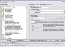
Soil Data Viewer allows a user to create soil-based thematic maps.
It is an application designed for correlation/estimation of soil properties.
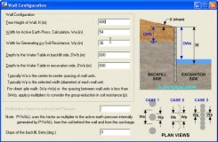
Software for better understanding of equivalent seismic loadings.
A program that allows to create and analyze residential designs.
Extends beyond the conventional method of analysis and design.